
Malden Neighbors Block Sources
A block search begins with records keyed to land and city geography. MapGeo displays parcels around an address. The assessor card adds the recorded owner, mailing address, assessment facts, and book or page clue. Ward and precinct maps add civic geography. Community sources can reveal public events or a contact route, but they do not create a verified resident roster. These source distinctions keep the records separate when researching Malden neighbors.
| Source | What It Shows About a Block | Access and boundary |
|---|---|---|
| Malden MapGeo | Parcel geometry, owner attributes, parcel ID, street name, and map context | Free public reference viewer; parcel edge is not a social connection |
| Malden WebPro | Recorded owner, situs, property mailing address, assessment, sales, and book or page | Public assessor data; owner is not automatically an occupant |
| City GIS maps | Ward, precinct, voting location, zoning, and assessing context | City map and data layer, not a household list |
| EnerGov and city records | Property jackets, permits, inspections, certificates, and code-related records by address | Existing public records only; an applicant is not automatically an owner or occupant |
| Neighborhood and civic sources | Public descriptions, meetings, events, and community contacts | Voluntary participation; no verified resident roster |
| Library historical sources | Earlier address, owner, and community clues from directories, poll books, and newspapers | Historical material, incomplete by year and not proof of a current household |
An owner can live elsewhere, use a different mailing address, hold property through a trust or entity, or own a vacant or rear parcel. A public tax card therefore confirms a recorded property relationship, not who is inside a home. Household members, guests, utility customers, and delivery recipients are not established by this block method.
Map Malden Neighbors by Parcel
Use MapGeo outward from one known address rather than trying to turn a street into a people list. Search for the address or street, select the target parcel, and read the parcel data. Then pan or click along its contiguous polygon edges. Record the nearby parcel IDs and situs addresses first. Only after that step should the matching WebPro owner data be compared. A deed or legal description controls when a map line and recorded land description appear to disagree.
- Find the starting address in MapGeo and note its parcel ID, situs address, and displayed owner field.
- Inspect the polygons that touch the target parcel and write down each adjacent parcel ID and situs address without assuming a personal relationship.
- Open the matching WebPro cards and keep each owner, property mailing address, assessment year, and book or page reference with its own parcel.
- Use ward, precinct, zoning, or flood context only as geography. Follow a deed trail only for the parcels needed for the specific historical question.
Malden MapGeo parcel viewer provides the Owner, ownerName2, Parcel ID, and Street Name fields used to begin a Malden neighbors search.
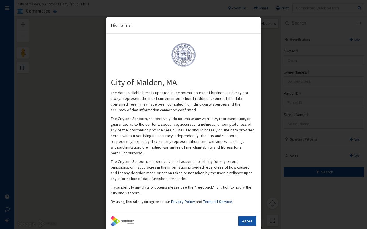
MapGeo supports parcel selection and map browsing, but the research capture did not expose a fixed buffer or measurement control label. Pan and select contiguous parcels instead of claiming a hidden radius tool. For a full named-street record chain, use the Malden by-street directory rather than repeating the block process for every address.
Malden Neighbors Parcel Field Checks
Keep the fields from MapGeo and WebPro in separate columns while comparing Malden neighbors. MapGeo offers Owner, ownerName2, Parcel ID, and Street Name as visible attribute fields. WebPro can add the location or situs, owner, current property mailing address, zoning, sale date and price, assessment year, legal reference, book or page, land and building values, and property description. A street search may also show parcel ID, location, owner, type, total value, beds or baths, lot size, finished area, land-use class, neighborhood, and sale information.
- Parcel ID
- The assessment and map identifier for a land unit. Malden records use a map-block-lot style such as 010 070 029, and a unit suffix can appear.
- Situs address
- The physical location of the parcel. It can differ from the tax mailing address.
- Legal description
- The deed's land description. It is the safeguard when an address number, map edge, or former lot arrangement is unclear.
- Book or page
- A Registry cross-reference on an assessor card that can help locate the recorded land document.
The WebPro data is updated annually when tax rolls are committed, although some ownership and inspection changes can be updated separately. Treat the current display as an assessment record and verify a disputed ownership detail through the recorded deed image.
Malden Neighbors Voter Search Myth
Important limit. The Massachusetts voter-status form is not a block roster. It asks for an individual's first name, last name, month, day, year of birth, five-digit residential ZIP, and an agreement checkbox. Its stated purpose is for an individual checking their own registration status. It cannot be used to browse every voter on a Malden street. Public annual-register or local-list information follows a separate local process, and confidential registrations are not public.
The Malden Registrar of Voters is in City Hall, 215 Pleasant Street, Room 220, at (781) 397-7116. Ask the Registrar about a specific lawful local annual register or list and its allowed format or fee. Do not treat a no-match as proof that a nearby person is absent, and do not infer a protected address from any other public record.
Note: Ward and precinct maps can explain election geography, but they cannot identify the voting choices or private registration details of neighbors.
Map Malden Neighbors by Neighborhood
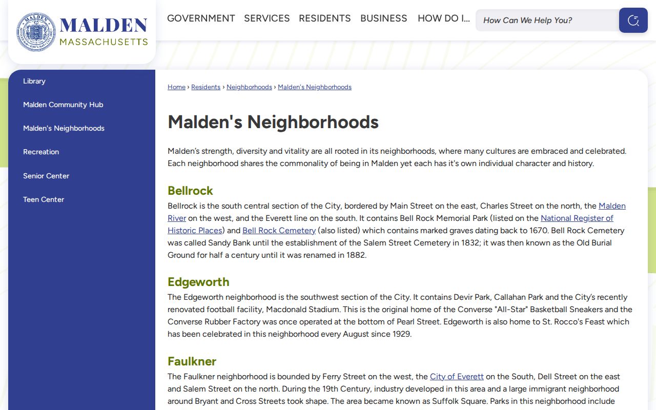
City neighborhood descriptions give useful context around a block without identifying residents. The official city pages describe Bellrock, Edgeworth, Faulkner, Ferryway, Forestdale, Linden, Maplewood, and West End. The City's Master Plan also maps planning areas including Oak Grove, Upper Highlands, Belmont, Industrial Park, Suffolk Square, North Faulkner, and Linden. These boundaries are a geography layer. They should not be substituted for a parcel boundary, a city limit, or a list of everyone who lives nearby.
Malden's official neighborhood descriptions provide the city context for a Malden neighbors search.
Ward and precinct information can be checked with the City's GIS maps. The GIS Office is at 215 Pleasant Street, fifth floor, Room 540, (781) 397-7154. Its published schedule is Monday, Wednesday, and Thursday from 8 a.m. to 5 p.m.; Tuesday from 8 a.m. to 7 p.m.; and Friday closed. The office also identifies public assessment-data downloads and city map resources.
Malden Neighbors Community Leads
Community groups can be a respectful way to learn about public meetings, local history, or join processes. They are not a source for guessing membership, addresses, or household relationships. The available Malden sources identify public roles and contact routes, not a resident directory. Use the group's public contact or event channel, and leave private participation private.
| Community source | Role or geography documented | What the source does not provide |
|---|---|---|
| City neighborhood pages | Official descriptions and maps for Bellrock, Edgeworth, Faulkner, Ferryway, Forestdale, Linden, Maplewood, and West End | Member lists or a neighborhood roster |
| Friends of Oak Grove, or FOOGI | Oak Grove public website, open meetings and events, with connections to the City | A member directory |
| Maplewood Association | Maplewood group identified through the Malden Community Coalition; contact through the group or community hub | A public member roster |
| Friends of Fellsmere Heights | West End and Fellsmere civic interest group identified in the coalition inventory; contact through the group | A resident directory |
| Malden Community Coalition | Umbrella community coalition with monthly meetings and public resource or community contacts | A private member list |
The coalition inventory also names Friends of the Malden River, Malden Neighbors Helping Neighbors, Malden Safe Streets, Malden Pride Coalition, North Shore Hispanic Association, Malden Historical Society, Malden Kiwanis, and other groups. Public events and contact pages can support civic participation, not household identification.
Malden Neighbors Permit Trails
For a block question about construction, a property change, or a public code trail, use the city's address-keyed records rather than assuming a change from a parcel owner's name. Malden Inspectional Services' EnerGov public search covers property jackets, permits, inspections, certificates, payments, issued permits, and code-related records. A permit date may show when a renovation, addition, or other property event was recorded. It does not by itself establish who owned, occupied, or performed work at the address.
Malden Public Records Requests is the fallback for clearly described existing city records outside a portal. Name the address, parcel if known, type of existing record, and date range. A written request is useful under Massachusetts Public Records Law, M.G.L. c. 66, § 10, because it clarifies the search and preserves appeal rights. Birth, marriage, and death certificates use the City Clerk or state vital route instead of a public-records request.
Malden Neighbors Source Comparison
The best source depends on the question. Official parcel and city records identify their custodian, date, and record type. Commercial neighbor tools are a data-broker category that combine public material with purchased or marketing data. Their results may be stale, merge people with similar names, or omit the record that would explain the claim. Use the official source to check a specific parcel, filing, or city record before acting on a result.
| Official source category | Data-broker category | Practical check |
|---|---|---|
| Map, assessor, deed, or city record with a named custodian | Mixed public and marketing data with varying provenance | Confirm the parcel, record date, and party role with the named holder |
| Bounded record such as a permit or recorded deed | Broad person profile that may blend names or addresses | Keep record purpose and time period separate |
| Correction path through the assessor, clerk, Registry, or agency | Provider-specific opt-out or correction process | Correct the original official record when it is wrong |
Note: A parcel boundary can show adjacency, but it does not prove friendship, family, shared occupancy, or any other private relationship between neighbors.
Malden Neighbors Privacy Boundaries
Massachusetts law protects several address trails that a map cannot reveal. The Address Confidentiality Program under M.G.L. c. 9A and 950 CMR 130 provides a substitute address and mail forwarding for qualifying participants. Confidential voter registration under M.G.L. c. 51 and 950 CMR 49 can withhold a voter's name and residence from ordinary public lists. The federal Driver's Privacy Protection Act, 18 U.S.C. §§ 2721-2725, protects DMV personal information. Court, vital, juvenile, adoption, sealed, impounded, and CORI records have their own restrictions.
Lawful use. Use Malden neighbor records for lawful personal, historical, civic, or safety research. Do not use a block search to stalk, threaten, intimidate, harass, or expose anyone.
Stop when an address or record is protected. Do not try to fill the gap with private utility, delivery, or household information, and do not turn adjacent parcels into claims about who knows whom. The relevant custodian can explain a correction or record-access process without disclosing protected details.